Check out these useful items


Daystar Hood Latch Upgrade Black Compatible with/Replacement for 2007-2018 Jeep Wrangler JK
Latest Blog Posts
- Jeep JK A/C Blend Door Actuator Replacement
- Jeep JK 3.6L V6 thermostat housing replacement
- My Jeep recovery gear
- Jeep JK 3.6L Pentastar Engine Oil Change
- Jeep JK Differential Fluid Change
- Jeep JK multi-function switch replacement
- Jeep Wrangler JK and JL Factory Bolt Sizes
- Jeep JK Jack Base by AEV
- Jeep JK Tailgate Tire Carrier by Rugged Ridge
- Jeep JK Dash A/C Vent Removal
Audiobook Recommendation

Location: Gold Canyon, Arizona
Difficulty Rating: Moderate
Route Type: Loop
Length: 9.0 miles
Usage: Moderate
Trailhead Elevation: 2,400 ft.
Elevation Gain: 800 ft.
Park Fee: No fee
Trailhead Amenities: parking, restrooms (portable), trail map and information
Directions: From Phoenix take US 60 east all the way to Gold Canyon. Turn left on E Peralta Road. Follow E Peralta Road north east. After about a mile it turns into a dirt road. Follow the road for about 7 miles, all the way to the end where you’ll find the trailhead parking lot, with overflow parking lot 1/4 mile back.
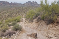
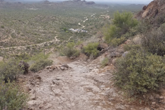
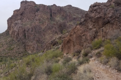
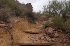
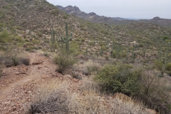
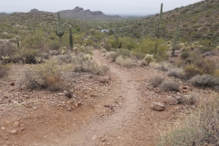
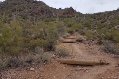
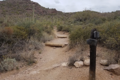
Miners Needle Loop is a moderate, 9-mile hike that follows portions of the Dutchman’s Trail and Bluff Spring Trail as they loop around a rock formation called Miners Needle. It’s located within the Superstition Wilderness. I would highly recommend bringing a hiking partner to complete this loop, since it is a very remote area and in places like this anything can happen. Just in case you come across a rattlesnake, scorpion, a spider, or weather suddenly turns for the worst, you would be safer having another person with you. And as with any hike in the desert, bring plenty of water.
The time to complete this hike will vary, depending on your pace and your breaks, but plan to be on the trail anywhere between 4-5 hours.
You can do this hike clockwise or counterclockwise, however when you go counterclockwise you have a more gradual climb up followed by a steep descent back to the trailhead.
From the Peralta trailhead, head out east following the Dutchman’s Trail #104. After passing the beginning hills the trail drops down into Barkley Basin. It’s a scenic hike across. Passing the junction with Coffee Flat Trail #108, Dutchman’s Trail starts to switchback and climb. Once you make it through the five or six switchbacks you start heading northwest. Soon you will pass the right (east) side of Miners Needle. Passing the north end (keep looking up) you have a great view through the “eye of the needle”. The eye is small so don’t get too excited. The trail makes a quarter circle around Miners Needle then heads north again. Shortly you come to the junction with Whiskey Spring Trail #238 at about four and a quarter miles. Continue on the Dutchman’s Trail down to its intersection with Bluff Spring Trail #235 at seasonal Crystal Spring. Take Bluff Spring Trail west to the junction with Terrapin Trail #234. To complete Miners Needle Loop, head back by continuing on the Bluff Spring Trail to the trailhead and parking lot, which is 2.3 miles away from this trail intersection.
If you’re ready for a next adventure and want to plan it right, check out some of these hiking guides – Arizona has so many awesome destinations to explore!

52 of the best day hikes in Arizona one for each weekend of the year, organized by seasons. Selected hikes ranging from easy walks in the woods to challenging journeys to Arizona s highest peaks and deepest canyons including the Grand Canyon. In-depth trail guides, descriptions, warnings and GPS coordinates are included with each hike, along with the magazine's classic fine photography.

It’s out there. Go find it! The Arizona Journey Guide by Jon Kramer and Julie Martinez is your resource to discovering the best of Arizona. Informative and entertaining, this guide leads you to 59 of the most amazing sites and scenery that the Grand Canyon State can offer: ancient ruins, secret canyons, hidden waterfalls, mysterious petroglyphs, and exotic places.

Stretching from Hidden Valley to the south to the Superstition Wilderness to the north, the book contains clear trail maps and profiles complemented by detailed descriptions and useful at-a-glance information. All roughly within an hour's drive of the Valley of the Sun, the trails highlighted in this updated edition begin right inside the city limits with popular Camelback Mountain.
Note: As an Amazon Associate I earn commission from qualifying purchases. It allows me to offer contents of this website free of charge to everyone.

